The Devil's Hairbrush
An Emotional Rescue, and the Sweet Song of Highbush Blueberry
I have been a little lax about posting my Pine Barrens adventures, and I hope you’ll forgive me. I’ve been out there nearly every weekend, as it remains one of my favorite places to explore. You do need to be careful; the roads can be treacherous, and cellular signal is often spotty. Last week, I went out for what was supposed to be an easy trail ride from Atsion to Batsto with the Mtn Roo Tri-State Group of Subaru enthusiasts, and it turned into a rescue mission:
The driver did exactly what I did when I got stuck: they drove straight into a mudhole. I got lucky and “high centered,” miring in a rut that lifted all four wheels away from good traction. Which in turn saved me from this driver’s predicament: water in the engine, which destroyed it. I got away with a $250 tow. As you can see, a smaller vehicle that skirted to the sides made it through safely; here’s a video of the rest of the rescue crew safely navigating the washout, after the Sambar driver (the adorable little white truck!) checked depth by wading through the mud in knee-high galoshes.
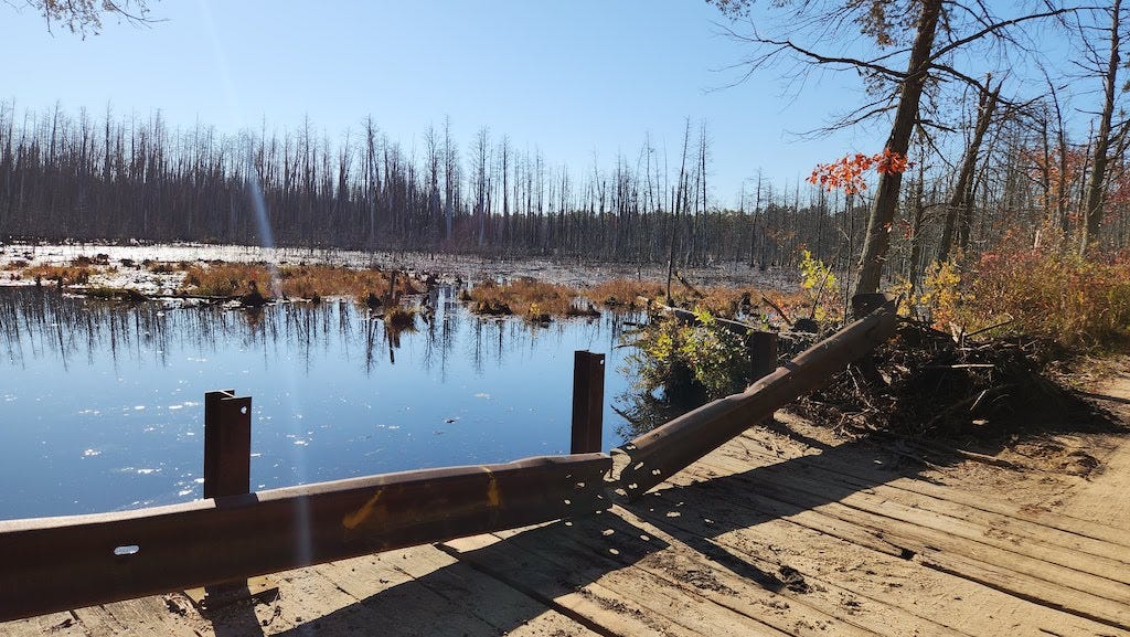
But it’s not all danger out there, and there is so much beauty. For example, this section of dead Atlantic white cedar forest in the middle of pitch pine, known on Google Maps as “The Devil’s Hairbrush.” (Experienced Pine Barrens explorers scoffed at the moniker, and knew the area). I assume the name comes from the dead trees resemble the teeth of an enormous comb in the distance. What killed the trees? It’s too far inland to be due to saltwater encroachment, which destroys cedar forests along the Mullica and Bass River. This isn’t far from where a mass replanting project is taking place, in Brendan Byrne State Forest. Follow the link to see aerial photos of cedar forests thriving in the pines.
The Pine Barrens has one of the largest stands of Atlantic white cedars remaining along the coast. They’ve been harvested as long as humans have inhabited the area, and the old growth was gone before the colonists turned the pinelands into a charcoal, iron smelting, and shipbuilding graveyard. Tales of enormous preserved specimens pulled out of bogs and turned into desks for rich men abound. It was a beautiful place to visit, and I’m glad I made it. It’s a bit further than my usual haunts in Wharton State Forest, but very much worth the trip. Here’s a video of me slowly cruising along the swamp, interspersed with photographs:
I pulled over to just drink in the eerie beauty of it all. It’s not far from a spot known as Pomeroy’s Corners, named after a hunter who frequented the area. I was positively giddy with excitement over how this place lived up to the name. After the homogenous pine plantations, it was a pleasant surprise:
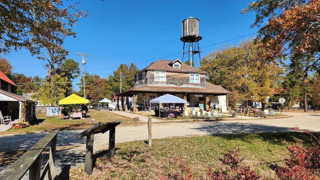
From here, I drove on to Whitesbog Historic Village, where the wild blueberry was first domesticated. As I love these little tart bastards, this was a pilgrimage of sorts. Named after the White family, who harvested cranberries and blueberries. Not themselves, mind you. They were rich, and hired others to do it. Blueberries and cranberries had been cultivated by Native Americans, through burns and other methods; cranberries are now grown in single crop bogs which are flooded, then picked with “egg beaters.” Blueberries were more difficult to tame. A field of wild lowbush blueberries might have a dozen different kinds. Elizabeth Coleman White began as the daughter of a Quaker family, supervising the harvests; after observing for many years, she contacted a botanist and they worked together with local Pineys, paying them to bring in tall plants with large, blue berries. They bred them and domesticated the northern highbush blueberry1, the big medium-blue ones we have become accustomed to getting all year long, from Maine, New Jersey, and even Peru.
The village has been preserved, from the packing houses to the general store, and makes for a nice visit. I planned my trip around a country living festival with music, but after wandering the grounds for two hours and listening to the bands tune up and not play, I bought some delicious cranberry salsa and hoofed it home. I was rather disappointed that I didn’t get to hear the music, but when you say your event begins at 10:00am and the music plays from 11 to 1, the jamboree had better be jumping by noon! This never developed past a shindig into a hootenanny or a jamboree, and was more of a craft fair with a few preserved buildings full of vintage photographs. Which was nice enough. It could have used a food truck or two. Here’s a musician playing to test the sound system, which was pleasant enough on a lovely day.
And here’s a short walking tour of the village that shows cabins and a packing house:
Getting out into the Pines is therapeutic for me, whether by foot, car, or bike. (And next year, by kayak.) The area may not rival Del-Mar-Va, the Pacific Northwest, or Montana for size and natural beauty, but it’s a unique place that everyone can explore, get lost in, and usually not die. (Though that happens, sometimes.) I’ve been known to lose myself in a Costco, but my GPS has kept me safe.2 I love when people like my friend Johnny—a Marine who had to undergo orienteering training—attempt to teach me how to navigate. As a saxophonist, he has also tried to teach me rhythm, with similar results. Perhaps the two are related, but I only learn paths by rote, and I only learned to dance at my wedding—to the Dave Matthews Band, under extreme duress—my memorizing the steps like it was a very complicated martial arts kata. My brain just does not work that way. Muscle memory works, but neural pathways are disconnected from space and time.
That’s one reason that I’m reading How to Read Nature by Tristan Gooley. He writes about navigating with nature. I’m thrilled when a path that I’ve been walking for a year looks familiar to me, so maybe he can help. I am also going to sign up for Tom Brown’s Tracker School. It seems silly to live near the Pine Barrens and not take his course.
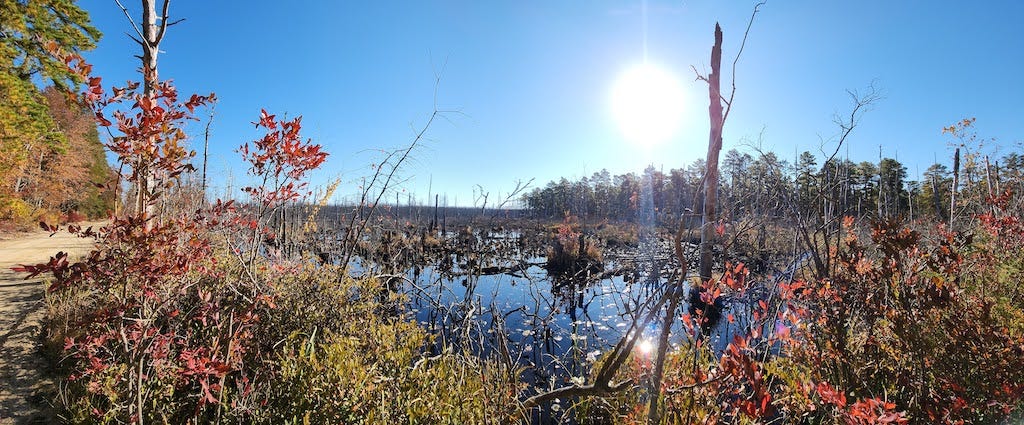
Here’s a panoramic photo I took of the Devil’s Hairbrush area:
After I left Devil’s Hairbrush I wanted to check out nearby Pakim Pond, which was nice, but nothing compared to where I’d been. However, on the way there, I found a road aptly named Muddy Road and I had to drive down it. It was just me and a dirt biker. It was a fun splash for the Subaru, and I made a highlight reel with the camera mounted on the hood, for those so inclined. It’s nothing as precarious as the washout that killed the other guy’s Subaru. (If you like these sorts of videos, @squatcharu Instagram feed is full of them.)
Highbush Blueberry is also my dancer name.
I have a car GPS, Google Maps offline on my phone, an external handheld GPS loaded with home-brewed maps from Boyds Maps of the Pine Barrens forums, and I recently invested in a Garmin GPS smartwatch, to give you a sense of how utterly bollixed my sense of direction is. I want Google Maps for the SuperTarget.


I love these episodes!
My dyslexic memory instantly turned this into Highberry Bluebush, who was probably a pirate...
Love this adventure, and all your pluckery posts!!!!