The Train Don't Stop in Atsion No More
The Ruins of an Iron Town, a Cotton Mill, and a railroad stop in the Pines
The iron town of Atsion was founded in 1766 by Charles Read, and remains on maps thanks to a manmade lake that bears its name, and the ranger station built in the remains of a general store that once served the workers of the iron forge, and the cotton mill that came after it. History seekers and ruin lovers can easily find the remains off of Route 206 in Shamong Township, a lovely spot in the Pines that comes from the Lenni-Lenape words meaning “Place of the Horn.”
The horn still blows at the Pic-A-Lilli Inn, a roadside bar and burger joint. The locals love the hot wings there, but in my opinion, it’s all about the corn fritters. Atsion takes its name from the Lenni-Lenape as well, “Atsayunk” was their name for what colonists called the Mullica River that runs through the Pines from the town of Berlin to the Atlantic ocean. Charles Read dammed the river and built an iron forge ten years before the colonies declared their independence, and built a powerful iron forge to process bog iron from nearby Batsto into pig iron. Later, this forge would cast iron used in the Lower Trenton bridge across the Delaware river in the state capital.
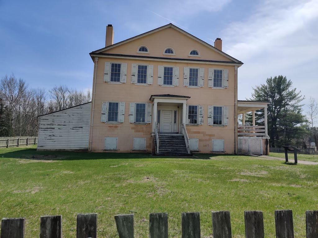
This is one of the easier and more pleasant ghost towns of the Pine Barrens to visit, and doesn’t require a four wheel drive vehicle. Just drum up Atsion Ranger Station in Google Maps, and you’ll get to the site of the restored mansion of the ironmaster. It’s currently closed to visitors, but I hope it will reopen soon.
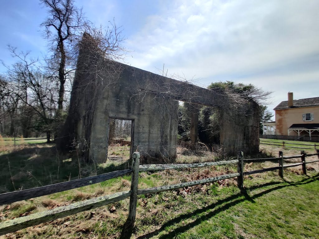
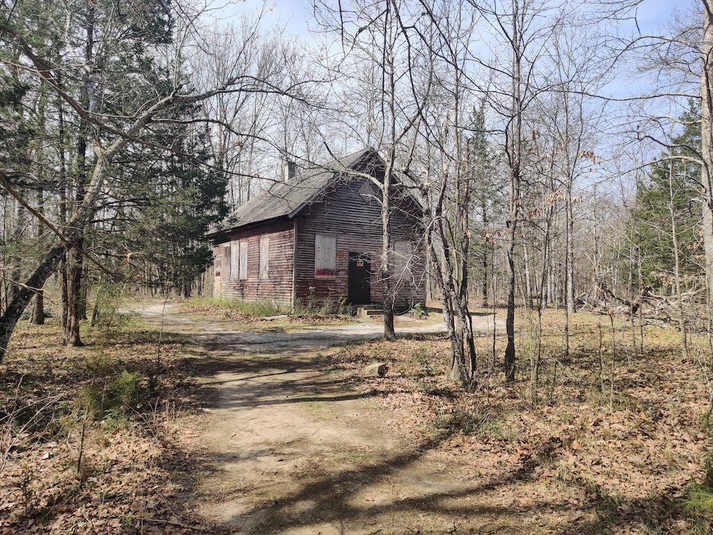
Next to the mansion is the general store now used as a ranger station, the remains of a concrete barn, and further back on the road is a historic church that is still in use and the ruins of an old schoolhouse. It’s been vandalized and is marked against trespassing.
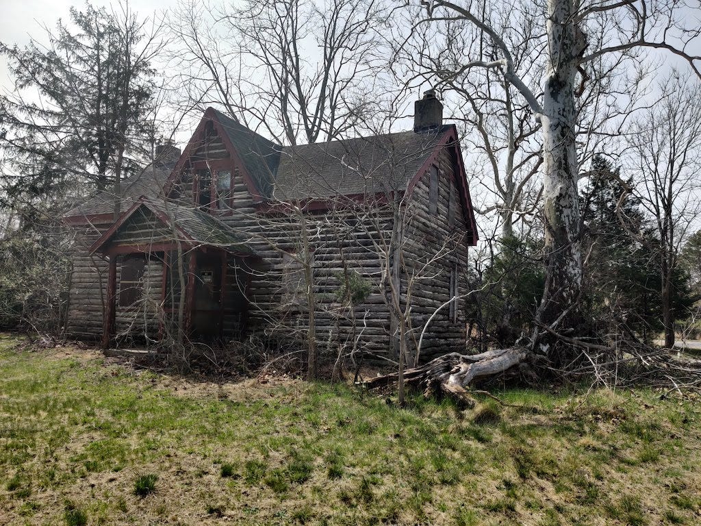
If you follow the road that the schoolhouse is on much further, you’ll want a four wheel drive; this is the road that the old stagecoach took, that I followed to Quaker Bridge. In a Subaru Outback or similar you can make it there easily, but following the trail from there to Mount and old Washington township you’ll run into deep washouts that will challenge a raised Jeep. I’m still trying to find a path there. I was going to try coming at it from Washington Turnpike this weekend, but we had a lot more rain. Don’t let that dissuade you. Just off Route 206, a little south of the ranger station, is a road to a campground and kayak landing with an old clapboard and mortar house that “dates to the iron era,” which I’m guessing means the early-mid 1800’s and not the colonial era, judging by the looks of it:
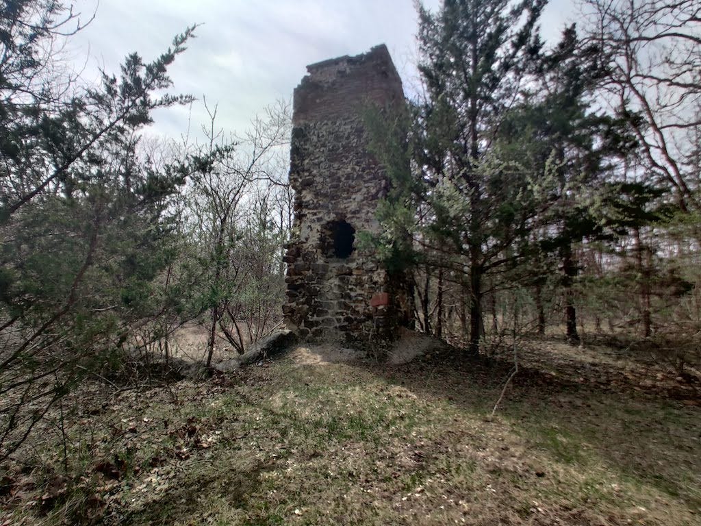
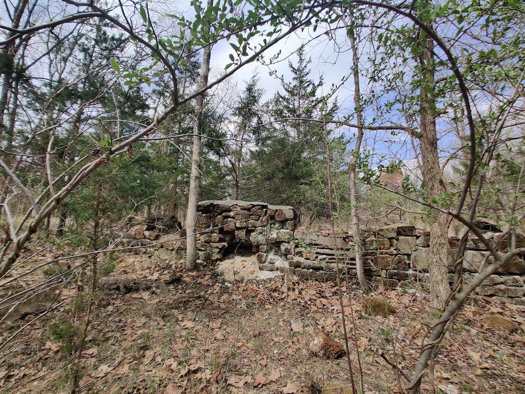
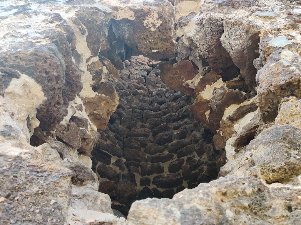
After you explore the house you can get to a parking lot where the remains of the iron furnace hide in plain sight, surrounded by trees. I missed it until I parked the car and walked around. If you’ve ever been to Scotland or Ireland where a few feet off the road are standing stones or dolmens, this is the Pine Barrens version; barely out of sight from a main highway is the hidden chimney of an iron forge that cast cannonballs for the Revolution and parts of a bridge still in use today.
People park here to put in kayaks, but just outside the parking area you’ll find the foundations of the ruined cotton mill.
There is more to explore here but these are the more exciting ruins. Further south, there is the cellar hole of an ironworker’s home that is close to the highway and easy to miss.
And if you follow the road behind it into the Pines, park and walk unless you’ve got a raised vehicle, as there are a lot of humps in the sandy roads. I made it over them in the Outback, which has just under ten inches of ground clearance. One road is marked off-limits from the forest service and it looks like there are ruins from a construction site they have cordoned off for safety. The other way in leads right to the location of the Atsion rail stop, but only the rails themselves remain. All that’s left of the station is an empty spot which makes it easy to turn around and head back to the main road. There are many of these abandoned rail lines in the Pinelands and they can give you a foot trail into places that are otherwise hard to reach. If you plan on exploroing them, make sure you invest in a handheld GPS and don’t rely on your phone, as reception is spotty and everything looks alike out here.
I went back and got close to the furnace, trying to imagine what they were like when fired. There are ruins of a gristmill but I wasn’t able to find anything. Pine Barrens historians are good at spotting piles of iron slag overgrown with underbrush, mill raceways that are manmade and not just a creek, but my eyes aren’t there yet. This is the “Jersey stone” that Henry Charlton Beck talks about.
If you want to explore this area, it’s easy to find where to start. Here’s a picture of the restored mansion that’s easily visible from the highway. If the ranger station is open, you can ask about what else is worth seeing, or pick up a map. It’s worth taking a ride to Quaker Bridge if you’re up for it.
Here’s a video of me driving to the Atsion railway that gives you an idea of the rises and dips. The road to Hampton Furnace begins just north of Atsion mansion, and is a lot more rutted and potholed, so drive slowly…




I am loving the banjo accompaniment to your rambles. Such a jaunty way into these kinda spooky abandoned landscapes where you have to bring a GPS because all the pine trees look the same. I mean. It’s just beautiful.